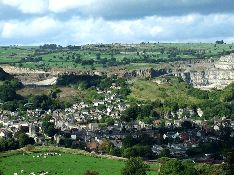

Although the society has investigated remains from various time periods, the main focus is on the Roman and Mercian eras, in an attempt to establish the origins of the town. Specifically, it aims to find evidence that Wirksworth had its origins as Lutudarum, a Roman town known to have been located somewhere in the Peak District.
Figure 1: Wirksworth, Derbyshire
Lutudarum first recorded in the Ravenna Cosmography, compiled in 700AD and was an important centre for lead mining in Roman Britian, with various lead artifacts identified around Britain marked as being made there, though its exact location is unknown. Other modern settlements have been speculated as its being its location, including Matlock or Carsington. However, based on the distribution of Roman finds in the area, Wirksworth remains the most likely candidate. It is known that a Roman road extended across the Peak District from Aquae Arnemetiae (Buxton) to Derventio (Derby), though the route of this road at the Derby end is speculative. Part of the aims of the project are to prove that the Roman road network extended into Wirksworth.
Some of the society’s most interesting work over the last few years has been at The Meadows, an area of open land in the centre of the town. A series of features identified were identified on LiDAR and targeted for excavation. The most successful of these revealed the stone foundations of a late-Saxon building. Associated pottery evidence ranges from around 950AD to 1250AD, suggesting it was occupied for around 150 years either side of the Norman Conquest. This must have been a fairly important building, given at the time most buildings were constructed of timber. The building also features evidence of a water supply, something also rare for this period.
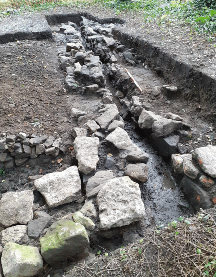
Figure 2: Saxon building remains.
Over the last year, work has involved a series of test pits at Ian Avenue, on the location of an ovular cropmark identified on a 1950’s RAF aerial photo prior to the construction of the modern housing. The size of this feature is evident when comparing to housing visible on the photo, though what this feature pertains to is currently unknown. The feature is situated towards the base of a slope in the landscape. Prehistoric features would have been expected to have been located on higher ground, and there are no records of later medieval or post-medieval structures. As such, the hope is that this cropmark originates from the remains of a large, circular Roman structure. Work on finding evidence of this will continue in 2024.
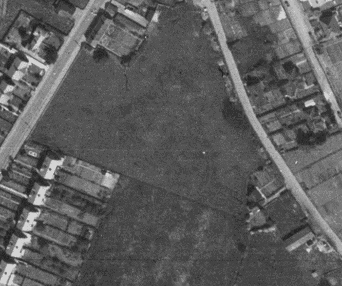
Figure 3: Ovular feature faintly visible on a 1950’s RAF photo.


Kimberley joins us as our new Health & Safety Officer and has a strong background in keeping people safe under pressure and understands the importance of proactive, practical safety measures.

We’re delighted to welcome Daria Madders to the Brindle & Green team as she steps into the head of landscape role and brings with her fresh energy, ambition, and a desire to make a real impact.

We’re excited to welcome Eddie to the Brindle & Green contracting team as our newest Contracting Technician.